
GIS Platform
This system collects Formosat-2 satellite imagery of Taiwan before and after Typhoon Morakot which has been processed through band-to-band registration, orthorectification, spectral summation intensity modulation, self adapt stretch and enhancement and superoverlay as 2-meter resolution images. These data are categorized by important disaster areas and published on our cloud server. Users who are interested in disaster conditions can browse these free 3D images from our website.

This system collects Formosat-2 satellite imagery of severe global disasters which has been processed through band-to-band registration, orthorectification, spectral summation intensity modulation, self adapt stretch and enhancement and superoverlay. These data are categorized by important disaster areas and published on our cloud server. Users who are interested in any global disaster events can browse these free 3D images from our website.

CEPD Environmental Sensitive Areas Safety Assessment System
After Typhoon Morakot, the government underwent the safety assessment of environmental sensitive areas and some villages. It took several months to complete safety assessment of more than 400 villages. This CEPD project was led by our president, Dr. Hwung-Hweng Hwung, with more than 10 professors and experts involved in survey and on-site investigation. This system is designed to prepare geo-spatial data before investigation and publish assessment reports and photos after survey. In addition to Formosat-2 satellite imagery before and after Typhoon Morakot and assessment list, we also add layers including, aerial photos, municipalities map, watershed map, debris flow distribution map, geology map and so on.

FB Taiwan Landslide Information System
Formosat-2 satellite has started its mission since 2004 and it has collected imagery of Taiwan since then. To comprehend the distribution and changes of landslides in Taiwan and assess its recovery conditions, we establish this system for advanced analysis. Satellite imagery of Taiwan from 2004 to 2012, results of 9 years’ landslide interpretation and results of 9 years’ annual analysis (including increased, enlarged, recovered and disappeared landslides) will be published in this system. These data can be overlaid by municipalities map, forest district map and watershed layers.

Combined characteristics of CEPD Environmental Sensitive Areas Safety Assessment System and FB Taiwan Landslide Information System, this system aims to integrate different geo-spatial information, including Formosat-2 imagery, aerial photos, UAV photos and panorama photos. In addition to reinforce general public’s awareness of disaster prevention, this system also applies cloud technique and single/double/four windows browse function.

THB Highway Disaster GIS Decision Support System
(4 procedures version)
This system is based on our THB project and will play an important part as THB’s decision support platform in highway disaster prevention and relief. Along with geo-spatial layers, we also add new layers in accordance with 4 procedures: prediction, deployment, warning and response. Information such as QPESUMS, rainfall and warning light of vulnerable highway section will be updated continually.
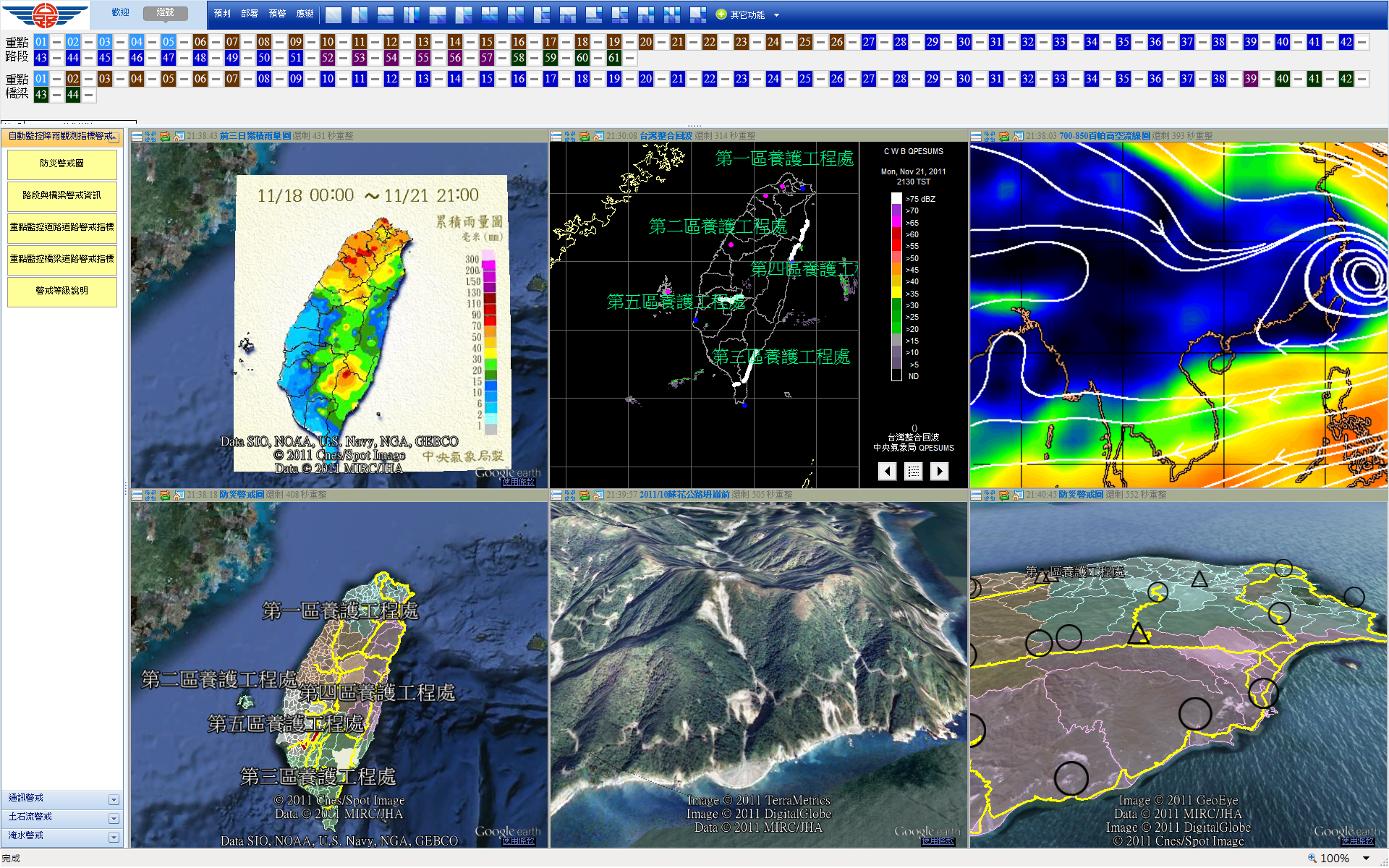
THB Highway Disaster General Information System
This website offers highway disaster warning information and expects to ensure the safety of highway drivers.

THB Highway Disaster GIS Decision Support System
(Tablet PC Version)
This system is the Tablet PC version of THB Highway Disaster GIS Decision Support System. With build-in data, users can browse this system off-line unless they want to see updated information. Since the hardware of Tablet PC is not as efficient as desktop computer, we are working on the Android version of this system.
