
Web-GIS
The Application of Web-GIS
1. The critical techniques that inhance Web-GIS multi-stage, layers integration and 3D display: Superoverlay and Super KML Regions

Superoverlay: Yushan, Formosat-2 2-meter Orthorectified imagery, 2011
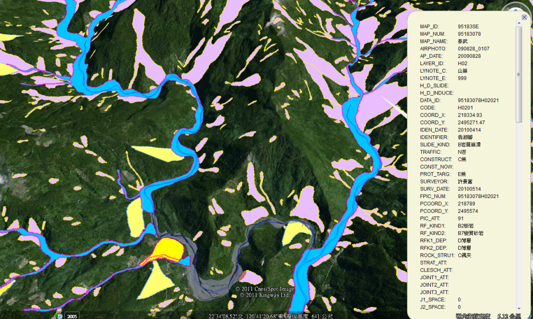
Super KML Regions: map of potential hazard
2. The critical technique to simplify Web-GIS cloud publishing procedures and reduce maintenance costs of cloud computing service: NCKU cloud computing service
3. The critical technique to level up real time data display
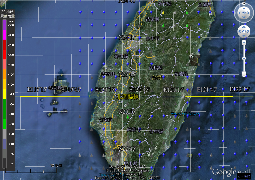
QPESUMS Radar Rainfall Precipitation Data
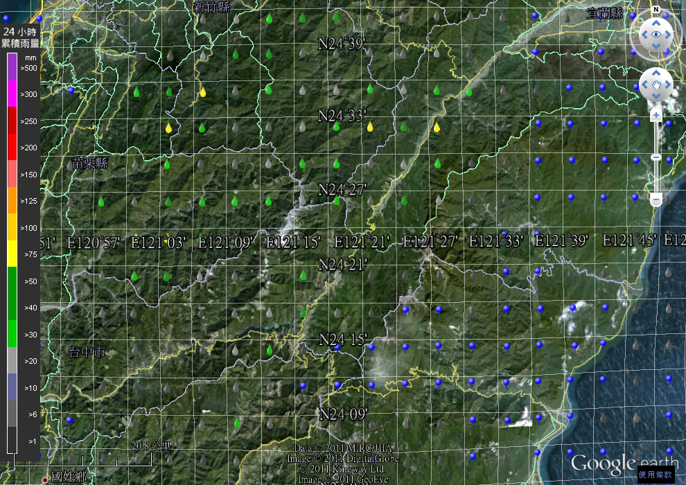
QPESUMS Radar Rainfall Precipitation Data
4. The achievement of GEODAC GIS Platform